The Tramways (and other railways) of
São Luís, Maranhão state, Brazil
BY Allen Morrison
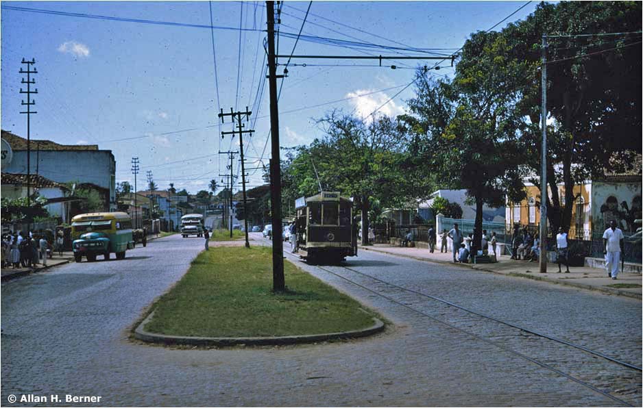
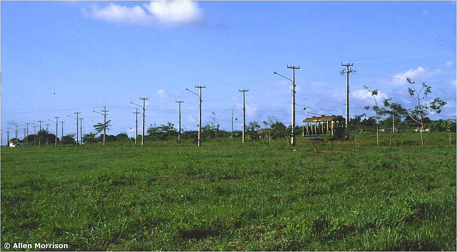
São Luís, Maranhão state, Brazil
BY Allen Morrison
The capital of Maranhão state is located on the north shore of Ilha de São Luís, an island about 30 km wide and 50 km long on Brazil's north coast, 3,000 km directly north of the city of Rio de Janeiro [see map]. São Luís was founded by French colonists in 1612, captured by the Portuguese in 1615, occupied by the Dutch in 1641, and reclaimed by the Portuguese in 1845. Today it is said to have the finest collection of Portuguese colonial architecture in the Americas. (UNESCO accorded World Monument status to 1,100 of its buildings in 1997.) Sugar and cotton were the region's major exports until large iron reserves were discovered nearby in the 1960s and a new railroad was built to transport the ore to São Luís harbor. The city's population was about 30,000 in 1870, about 60,000 in 1920, and is about a million today.
The area's first railways were horse-drawn. The government approved the construction of a street railway in 1870 and a franchise was awarded on 14 January 1871 to José Maria Bernes [some sources say Barnes] for the operation of "bondes animálicos" within the city – and vehicles powered by either animals or steam beyond. The contract specified that the tramway must be modeled on the lines of the very successful Botanical Garden Rail Road and Rio de Janeiro Street Railway systems in the capital, which had begun operation in, respectively, 1868 and 1869 [see transcription of contract]. Track gauge must be that of the RJSR: 4 ft 6 in / 1372 mm. Bernes formed the Companhia Ferro Carril São Luís do Maranhão, began laying rails and ordered an assortment of open and closed trams from John Stephenson Co. in New York, which had built the equipment for the Rio lines. The first photograph, which shows 6-bench open car number 12, was taken at the U.S. factory before its shipment to Brazil: 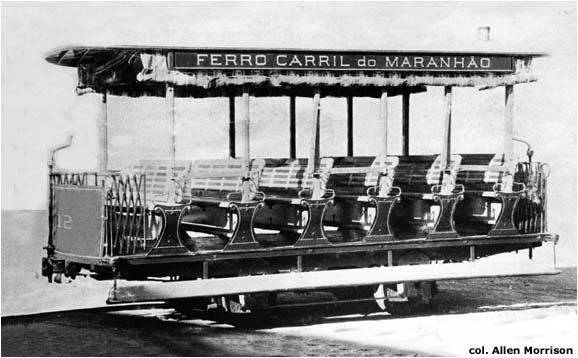 Bernes inaugurated the city's first tram route, between Largo do Palácio near the harbor (later called Av. Maranhense, today Av. Pedro II) and the Estação (tram depot) on the east side of town, on 1 September 1872 [see 1873 text and map]. It was the first railway in Maranhão province and one of the first street railways in Brazil. Another line, from Largo do Palácio to Largo dos Remédios, via Rua Grande and Rua dos Remédios, opened on 4 October. A third line, from Largo do Palácio to the cemetery at São Pantaleão, via Rua Grande, Rua do Passeio and Caminho do Gavião, began carrying passengers on 9 December. And an 11 km suburban line, which ran the entire length of Rua Grande and Caminho Grande, then beyond to Cutim, was inaugurated on 5 April 1873 (see map). The following illustrations provide brief glimpses of the city's first tramway service. 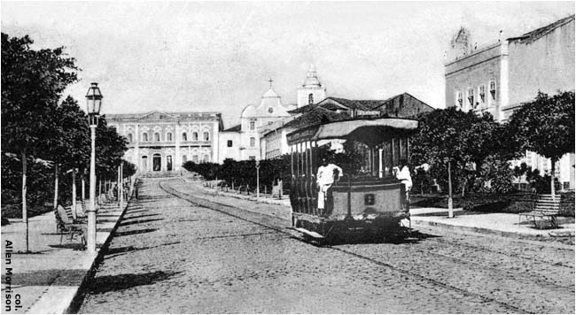 [2] This postcard view shows a 6-bench car at the tramway terminus at Largo do Palácio (today Av. Pedro II) (see map). Note the wide track gauge and the second pair of rails that allowed trams to pass. That's the Palácio Episcopal (Bishop's Palace) in the distance, next to the city's cathedral [col. AM]: 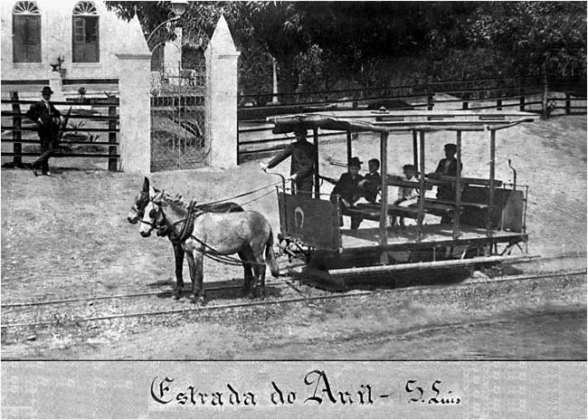 [3] The photograph above shows a 4-bench tram of the Companhia Ferro-Carril on the Cutim line [see map]. The tramway company was reorganized in 1879 as Empreza Ferro-Carris Maranhense and given its final name, Companhia Ferro-Carril Maranhense, in 1886. [col. Museu Histórico de São Luís] |

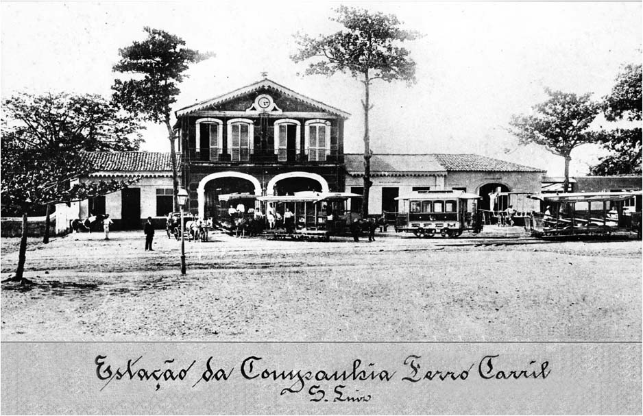
[4] The vehicles shown in this wonderful (but undated) depot view bear the initials "CFC", "EFCM" and "EFC". Location of the Estação is believed to have been at Monte Castelo, where the electric tram station was built many years later [see map]. [col. Museu Histórico de São Luís]
Tramway service deteriorated in the 1880s. The city was spreading beyond its borders and the fleet of tiny horsedrawn cars was no longer adequate for the growing population. The Ferro-Carril Maranhense was criticized by both passengers and the press, which claimed that it had not fulfilled the terms of its contract. FCM countered that its revenue was not sufficient even to feed its animals. The Maranhão government injected massive financial aid into the company that enabled it to make dramatic changes. It purchased new equipment and converted the outer end of its Anil line, beyond the Estação (tram depot), to steam traction [see map]. The record books of the J. G. Brill Co. in Philadelphia show 15 orders for railway equipment placed by "F. C. de Maranhão" between 1891 and 1894: both 4- and 8-wheel box cars, cattle cars, gondolas, mail cars, baggage cars and large passenger coaches – both open and closed models. |

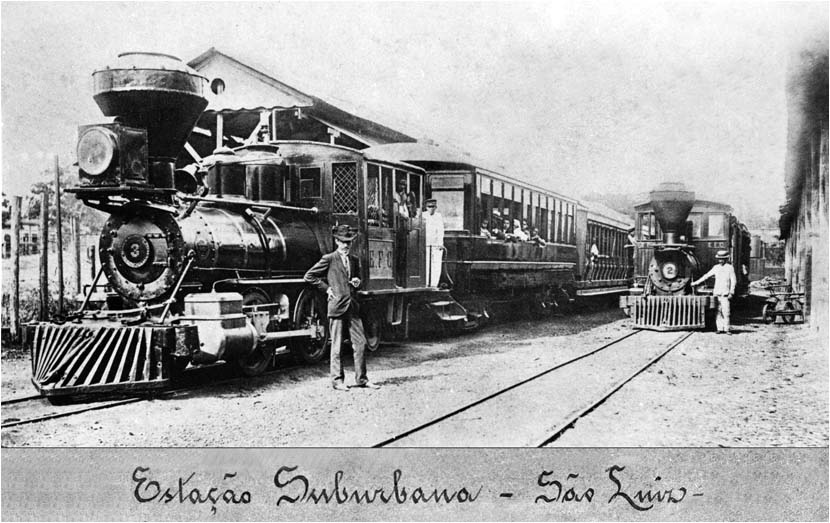
[5] The photograph above shows two of the Brill coaches in operation in São Luís, and also two Baldwin locomotives (also built in Philadelphia). (The project may have been inspired by the steam-powered street railway in nearby Belém, which also used Baldwin locomotives and Brill passenger cars.) Where was the "Estação Suburbana"? Does "E.F.C." on the locomotives mean Empresa Ferro-Carris? Whatever it was called, the tramway company inaugurated steam-powered passenger service between the Monte Castelo tram depot and Anil on 22 January 1893 [see map]. [col. Museu Histórico de São Luís]
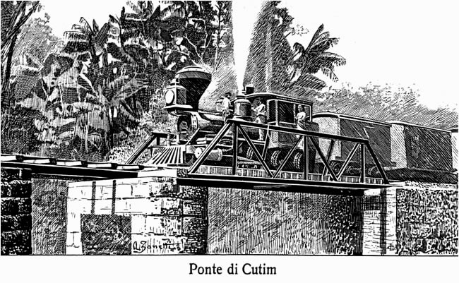 [6] Anil at that time was a textile center, and the new steam trains greatly facilitated transport for the factory workers. Anil was also a picturesque place crossed by small rivers and became a recreation and sports center, had a bullring, velodrome, and areas for picnics and concerts. The Ferro-Carril thrived for awhile. But an Italian visitor in 1905 found only one locomotive in operation and infrequent passenger service. The engraving above from his trip report shows a freight train on the Anil line with the same type locomotive as in the photograph above [also see another picture] [Timeteo Zani, 1905, p. 399: see BIBLIOGRAPHY] The 1908 report of the Instituto Brasileiro de Geografia e Estatística ["IBGE"] states that Ferro Carril Maranhense operated 14.8 km of "tracção animal-vapor" in 1907 [see BIBLIOGRAPHY]. IBGE's 1912 report shows only animal traction on 12 km of line – so apparently steam service ended between 1907 and 1911. The Estrada de Ferro São Luís-Teresina, the area's second and better known steam railway, finally reached São Luís in 1919. It used meter gauge and terminated at a large new station on Av. Beira Mar [see map]. ____________________ São Luís was one of Brazil's first cities to establish an animal-drawn street railway, but was one of the last to build an electric line. Its Câmara Municipal authorized the construction of an electric tramway in 1909, when electric trams were already running in a dozen Brazilian towns, including nearby Belém. The U.S. engineer Antonio Lavendeyra, who had built the floating docks in Manaus, proposed an electric system in 1911. South American & General Syndicate Ltd of London made another proposal in 1918. But nothing came of those projects. The contract to supply electric light and power, an electric tramway, machinery for cotton pressing, and facilities for fresh water and sewage disposal was awarded on 26 March 1923 to Ulen & Co. of New York. Ulen had experience with water projects in Uruguay and railroad construction in Bolivia and began immediately to build a meter-gauge electric tramway in São Luís. On 16 January 1924 Ulen ordered nine cross-bench open passenger trams of three different types from J. G. Brill Co. in Philadelphia: two 12-bench 8-wheel motor cars numbered 1 and 2; four 8-bench 4-wheel motor cars numbered 3 to 6; and three 6-bench 4-wheel trail cars (no motors) numbered 7 to 9. Illustration number [7] below shows Brill's photographs of cars 1, 3 and 9. [Brill Magazine (Philadelphia), July 1924, p. 190] 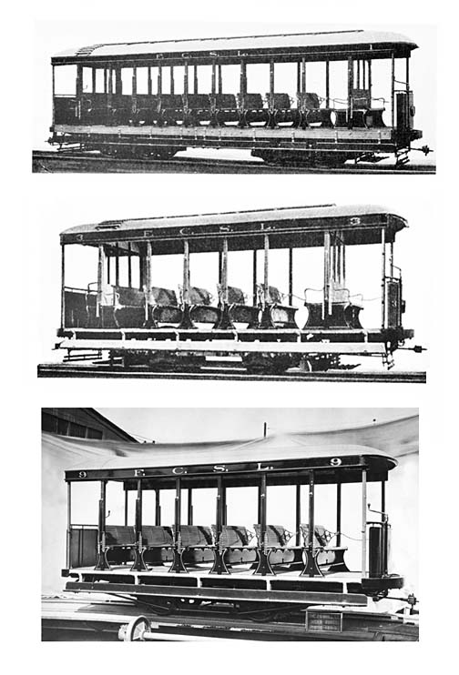 The vehicles arrived in Brazil later that year and Ulen's Ferro Carril São Luís inaugurated the city's first electric tram line, meter gauge, 11.2 km long, from Praça João Lisboa to Anil, on 15 September 1924 [see map]. It was the 37th electric tramway system to open in Brazil. Within a year FCSL opened two more lines and completed its initial network, which expanded the horsecar system of 1872. The Gonçalves Dias route connected the Remédios district with Av. Pedro II west of the city center. The São Pantaleão line formed a large counter-clockwise loop on the south side of town. The Estrada de Ferro line, which formed another counter-clockwise loop and served the new railroad station on the north, opened in 1927. Except for early closure of the latter route, the tramway system remained virtually unchanged throughout the remainder of its existence. After 52 years of horsecar service, passengers were delighted with the new electric trams, but began immediately to complain. Nine cars were not enough for 60,000 residents and frequent power failures left the vehicles stranded. FCSL ordered three more motor cars from Brill in 1926, but IBGE records indicate that they did not reach São Luís until 1936. Throughout the 1940s the IBGE lists show 13 passenger motor trams and 4 passenger trailers. Double-truck tram 2 and single-truck tram 9 were rebuilt as closed models and new equipment came from Trajano de Medeiros Co. in Rio de Janeiro. Some vehicles seem to have been renumbered. Good illustrations of São Luís trams in service are difficult to find. Picture postcards are the principal source of street views of the early 20th century, but the city's electric system opened long after the great postcard era. With a few exceptions, there is no photographic record of electric tram operation in São Luís in the 1920s, 30s, 40s or 50s. Judging from the clothing, the two postcard views reproduced below seem to have been made in the 1940s. |

[8] The first view, northeast toward the tram station, shows 4-wheel motor cars 7 and 5 and an unidentified trailer turning south toward Rua Grande. That's Rua da Paz, formerly Rua Collares Moreira, on the right [see map] [col. AM]:
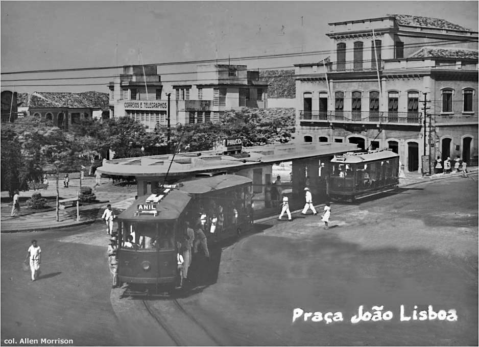
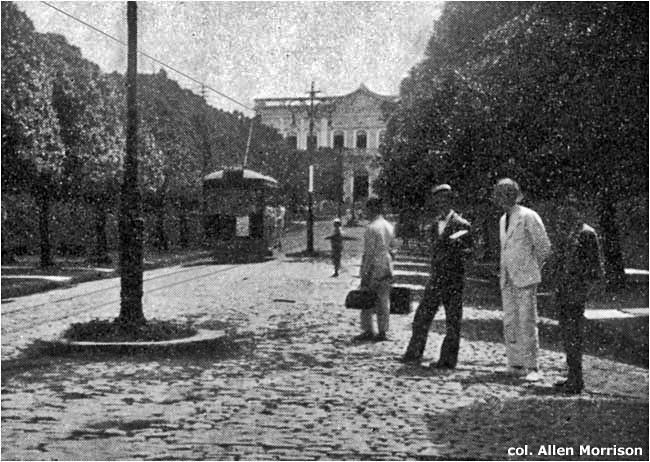 [9] The second view faces east on Av. Pedro II [see map]. The trees on the sides of the street can also be seen, a half century earlier, in photograph [2] at the top of this page. [col. AM] Ulen relinquished management on 2 May 1947 to the city's new Serviço de Água, Esgotos, Luz, Tração e Prensa de Algodão and the trams acquired the initials S.A.E.L.T.P.A. on their sides. When that operator gave way in 1959 to the Departamento de Transportes Urbanos de São Luís, their new initials were D.T.U.S.L. The latter company closed the circular Estrada de Ferro line and the Av. Pedro II branch shown above, and cut the suburban Anil line back to Filipinho [see map]. If it had not been for North American tramway enthusiasts who journeyed to São Luís in the 1960s, the pictures above might have provided our only glimpses of tramway operation in that city. Allan H. Berner of New York and Foster M. Palmer of Boston visited São Luís in August 1964 and June 1965, respectively, and provided the next dozen illustrations on this page. 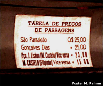 [10] Mr. Palmer grabbed this shot of a fare chart posted inside a tram: 25 cruzeiros in 1965 was about USD $0.014 – one and a half cents. The ride from the tram depot at Monte Castelo to Filipinho involved an extra fare. [Foster M. Palmer] 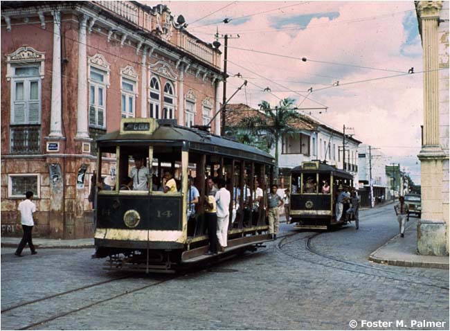 [11] Here are 4-wheel trams 14 and 10 traveling north on Rua Rio Branco at the corner of Rua da Paz [see map]. Number 14 is headed outbound for Praça Gonçalves Dias ["Pça G.DIAS"]. Number 10 is arriving from São Pantaleão ["S.PANTALEÃO"] and will turn left onto Rua da Paz in order to reach Praça João Lisboa. The destination boards on São Luís trams indicated the route. They did not indicate which way the car was going. [Foster M. Palmer] 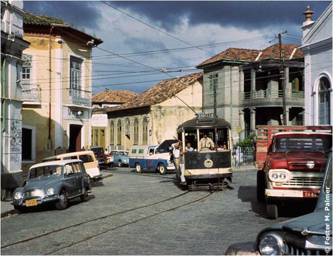 [12] The next photograph shows tram 13 arriving from São Pantaleão, headed west on Rua da Paz, at the curve just east of Praça João Lisboa [see map]. [Foster M. Palmer] 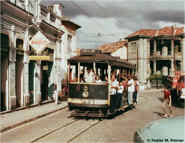 [13] Car 3 at the same spot as 13 in the preceding photograph. [Foster M. Palmer] 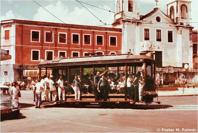 [14] Number 4 has just left the tramway platform on Praça João Lisboa, seen in black/white photograph [8] above [see map]. The view here is east toward Igreja do Carmo. The tram seems to have been better maintained than the church. Note the initials "D.T.U.S.L." on its side. [Foster M. Palmer] 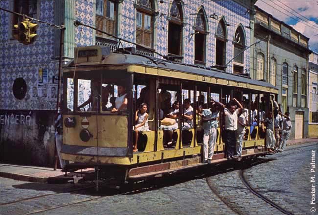 [15] Here is car number 1, one of only two 8-wheel vehicles in the tramway fleet. It is traveling west on Rua Grande, at the corner of Rua Rio Branco [see map]. [Foster M. Palmer] 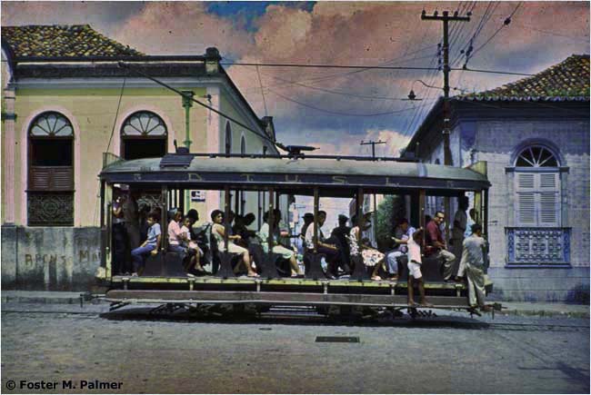 [16] Number 5 going west on Rua da Paz near Rua São João [see map]. [Foster M. Palmer] |

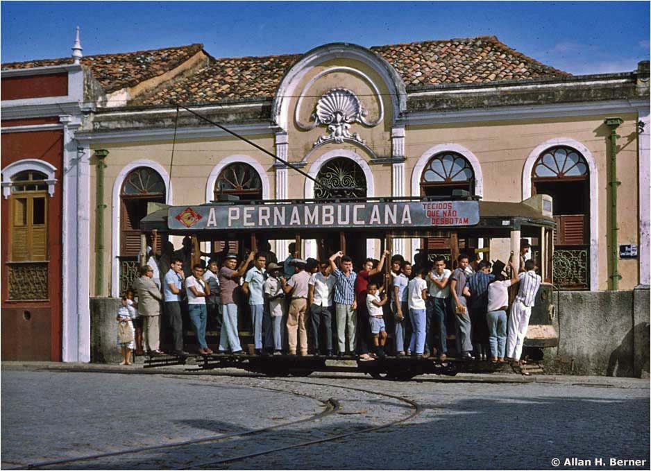
[17] Well-loaded car 6 traveling west on Rua da Paz, at the same spot as tram 5 in photo [16]. The unwired track turning north in the foreground was used by the Estrada de Ferro route, closed about 1960 [see map]. [Allan H. Berner]
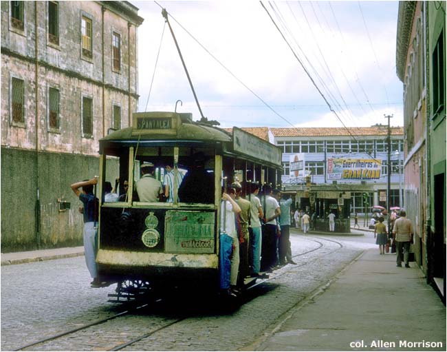 [18] An unidentified car traveling west on Rua da Paz, approaching the tramway platform on Praça João Lisboa [see map]. [col. AM] 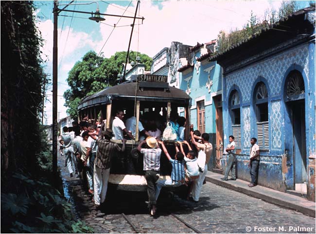 [19] Car 3 on the São Pantaleão line [see map]. [Foster M. Palmer] 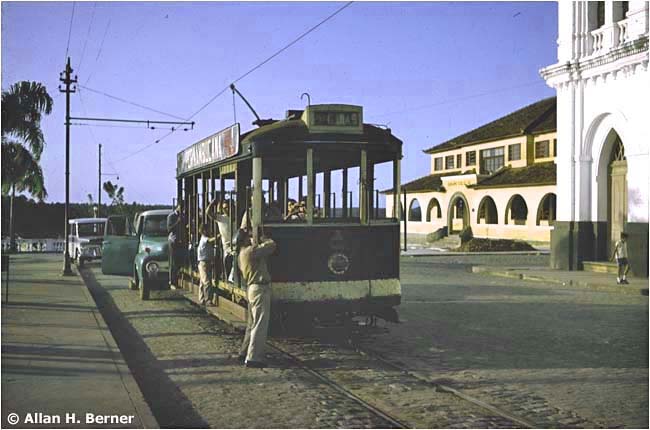 [20] The terminus of the Gonçalves Dias line, at the north end of Rua Rio Branco [see map]. The motorman is detaching the trolley pole from the wire, will walk it around the car and reattach it at the other end. The tram will then return on the same track. [Allan H. Berner] |

[21] Av. Getúlio Vargas on the Anil line, which D.T.U.S.L. cut back to Filipinho about 1960 [see map]. The tramway was on the south (or west) side of the median strip. The car is traveling inbound, toward the city – against outbound automobile, truck and bus traffic. The median strip may have been the location of the earlier animal/steam line. [Allan H. Berner]The preceding two pictures illustrate a major problem of the São Luís tramway system. The entire network was single track. The Estrada de Ferro and São Pantaleão lines formed large single direction loops, and therefore functioned without conflict [see map]. But the Anil, Gonçalves Dias and Av. Pedro II routes involved two-way operation on the same single track. There were a few passing sidings on the Anil line, but its rails were on the west side only of a busy, divided artery, as shown above. The entire tramway fleet used that thoroughfare going to and from the depot, and the problem became acute as automobile traffic increased in the 1950s and 60s.
On 6 July 1966 a new city administration ordered that tramway operation be discontinued on the streets involved – Av. Getúlio Vargas, Rua Rio Branco and Rua Grande (which became a pedestrian mall). This meant the end of the tramway system. The new Departamento Municipal de Transportes Urbanos de São Luís ("D.M.T.U.S.L.") operated the city's last tram, on the São Pantaleão line, around Christmas of that year. (Some say that service ended with an accident on that line on 11 April 1967.) A few trams remained at the depot on Av. Getúlio Vargas for several years. But most of the vehicles were scrapped. ____________________ 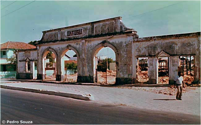 [22] When the author visited São Luís in 1980, this was what remained of the tramway depot, the Estação, on Av. Getúlio Vargas [see map]. Note that the new municipal company had inserted an "M" into the "D.T.U.S.L." above the entrance. [Pedro Souza] 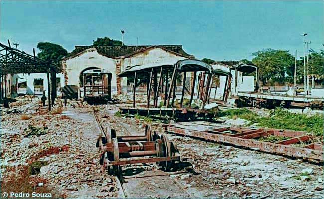 [23] The view inside the yard. The carcass of an 8-wheel tram (number 1? number 2?) sits on the right. [Pedro Souza] 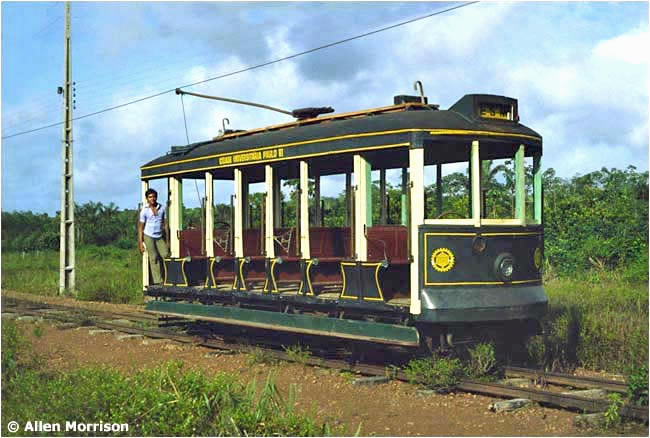 [24] Surprise! Twelve years after abandonment of the urban system, the Federação das Escolas Superiores do Maranhão ["FESM"] built an entirely new tram line on the campus of the agriculture school at Tirirical, 15 km southeast of town [see map]! A 4-wheel Brill car was restored and repainted, and 1.34 km of track was laid between a highway and the "Cidade Universitária Paulo VI" (named for Pope Paul VI, recently deceased). Brazilian President Ernesto Geisel presided at the inauguration of the new tramway on 26 October 1978. [AM] |

[25] The 4-wheel Brill car provided a free service for students every 10 minutes. [AM]
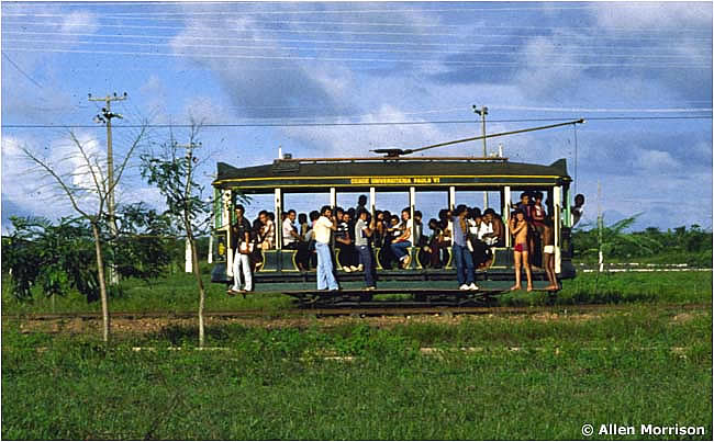 [26] A well packed tram – it was just like the old days! The original fleet number of the car could not be determined. [AM] 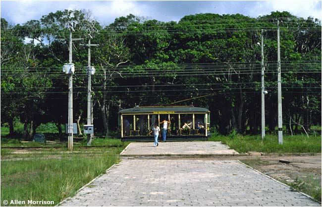 [27] A platform near the university end of the line. [AM] 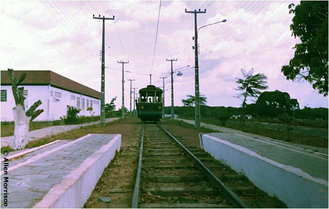 [28] This car has just left the loading platform near the bus stop on the highway. [AM] 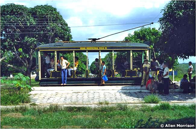 [29] The northern end of the line, where passengers transferred to buses for the journey into the city. On 30 December 1981 FESM became part of the Universidade Estadual do Maranhão ["UEMA"]. [AM] 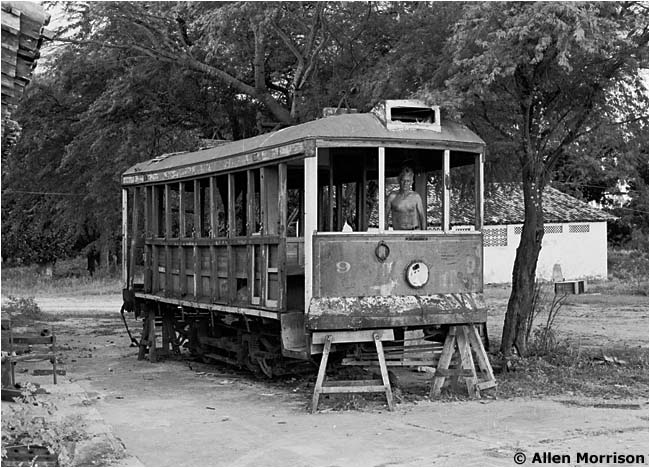 [30] In a patio next to the tram line, the author found another surprise. This is elusive tram 9, which Brill had built as an 8-bench open car in 1926, but which – along with 8-wheel open car number 2 – São Luís had rebuilt closed. It still has its Brill model 21-E truck. The steps are labeled "Trajano de Medeiros & Cia", the car builder in Rio de Janeiro. UEMA closed the Tirirical tramway in 1983, allegedly because of sewer construction, and it never reopened. Today, some of the track is still buried in the grass. But the city's trams seem to have disappeared once again... [AM] ____________________ In 1986, three years after closure of the little tramway at Tirirical, São Luís became the terminus of a completely new 892-km diesel-powered railroad that has become the most important in Brazil, one of the most profitable in the world, and the railroad with the the world's longest trains – 330 cars! The Estrada de Ferro Carajás was built to bring iron ore and other metals from a mining area in Pará state to Ponta da Madeira across the Bacanga River from São Luís [see map]. The line is owned and operated by Vale, S.A. (ex-Companhia Vale do Rio Doce), now the world's largest producer of iron ore. E. F. Carajás also carries 1,500 passengers / day to and from Anjo da Guarda station. Track gauge is 1600 mm / 63 in, the same used by most of Brazil's rapid transit lines. The meter-gauge E. F. São Luís-Teresina was cut back to a point near the airport in 1964 [see map] and there was a plan to convert the abandoned right-of-way to a light rail line. But the path was replaced instead by an automobile road. The railroad's passenger service ended in 1991. BIBLIOGRAPHY (in order of publication) Maranhão. Relatorio do Anno de 1873. Rio de Janeiro, 1874. "Ferro-carril" on p. 56 [from Provincial Presidential Reports 1830-1930]. Inauguration dates of the first tramway lines. Brief description of the company and its plans. "Requerimentos Despachados" in Diário Oficial (Rio de Janeiro), 31/1/1892, p. 456. Decreto permitting EFC to import from US without paying taxes/duty [more legible in PDF form, but requires registration]. Timoteo Zani. Al Parà, Maranhão e Cearà: Note di Viaggio. Milano, 1905. Account of the author's visit to São Luís in 1905, pp. 233 and 393. Train pictures, pp. 263 and 399. Brazil. Instituto Brasileiro de Geografia e Estatística ["IBGE"]. Directoria Geral de Estatística. Anuario Estatístico do Brasil. Rio de Janeiro, 1908-. "Emprezas de carris urbanos" sections each year report finances, traction type(s), track length, fleet and personnel of the principal tramways of Brazil. "Tramways" report in Brazil-Ferro-Carril (Rio de Janeiro), 6/1911, p. 8. Description of plan by U.S. engineer Antonio Lavandeyra to install electric lighting and tramway in São Luís. Vehicles would include an electric locomotive and baggage cars for the Anil line. "São Luís" news report in Brazil-Ferro-Carril (Rio de Janeiro), 8/11/1923, p. 582. Full page article describes the Ulen project in detail. "Open Cars for Maranhao [sic], Brazil" in Brill Magazine (Philadelphia), July 1924, p. 190. News item shows large photos of three tram models built for São Luís [see above]. Estado do Maranhão. Cidade de S. Luiz, Capital do Estado do Maranhão, Planta Confeccionada no Serviço da Carta do Estado pelo engenheiro José Abranches de Moura. 1926. Pará, 1926. Superb, large-scale street map with good detail of the new electric tramway system. Large, unidentified street map of São Luís dated 1938. Shows slightly different tramway routes from 1926 map above. [Both these maps were copied in the 1980s at the Geography & Map Division of Library of Congress in Washington, DC, USA.] "Tramways" in Brazil-Ferro-Carril (Rio de Janeiro), 31/5/1936, p. 249. Short news items mentions three trams coming to São Luís from the USA. Their origin and identity is uncertain. Prefeitura Municipal de São Luís-Maranhão. Secretaria de Urbanismo e Planejamento. Mapa da Cidade de São Luís, 1977. Large street map of the region on which a local engineer, John U. Gisiger, drew the tram lines, including the new one at Tirirical. "Bondes voltarão em São Luís" in Jornal do Brasil (Rio de Janeiro), 21/12/1979. São Luís mayor Mauro Fecury says that tram service will return in 1980... Ministério do Exército. Diretoria do Serviço Geográfico. São Luís, 1980. Topographical map, scale 1:100,000, shows southwestern section of São Luís island. Used as the basis for my regional map. Allen Morrison. "The University Tramway at Tirirical" - YouTube video transfer of my edited 6 1/2 minute silent film shot in 1980. A stranger added music and created a sound version! Raimundo Palhano. Coisa pública: Serviços públicos e cidadania. São Luís, 1988. Various articles mention São Luís trams. See especially "Bonds: Os Burros Vencem o Progresso" on pp. 296-310. Sylvânio Aguiar Mendes. Entre Burros e Empurrões: uma história dos bondes elétricos em São Luís (1924-1966). São Luís, 2005. Available as PDF. Scholarly, but despite the title the focus is almost exclusively on corporate and political history. Wilson Pires Ferro. Espelhos de São Luís: Artigos e Crônicas. São Luís, 2005. Collection of newspaper columns published 2000-2001 in O Estado do Maranhão. There are four essays specifically about the city's bondes, pp. 151-162. The author describes the tram itineraries in detail, expresses his fond memories of them, and hopes that the cars can be brought back. José Ribamar Martins. São Luís era assim. Brasília, 2007. São Luís memories, including a nice chapter on "Bondes", pp. 21-28. Route descriptions. Maria das Graças do Nascimento Prazeres, Francisco Alcides do Nascimento. Construindo a cidade: Os Discursos Oficiais referentes aos bondes elétricos na Primeira República em São Luís/MA. Teresina, nd [about 2008]. Good 12-page account of tramway development. Available as PDF. Maria das Graças do Nascimento Prazeres. "Na Trilha da Modernização: Uma Análise da Mobilidade dos bondes elétricos em São Luís do Maranhão", pp. 47-68, in Mobilidade Urbana em São Luis. São Luís, 2009. Nice broad tramway history, of the world, Brazil, São Luís. Recommended. Available as PDF. Jeferson Francisco Selbach. "Mobilidade Urbana nos Códigos de postura de São Luís/MA", pp 21-46, in his Mobilidade Urbana em São Luis. São Luís, 2009. Brief illustrated tramway history. See especially pp. 33-39. Available as PDF. Benedito Buzar. "Começo e fin dos bondes em São Luís" in O Estado do Maranhão (São Luís), 8/11/2010, pp. 20-21. Superb, full page-and-a half history of the tramways of São Luís. Wonderful large photograph of closed 4-axle tram number 2. Anderson Corrêa. Bondes de São Luís. Blog, 2011-. Interesting page with concise tramway history ("com informações do professor Benedito Buzar") and comments by readers. Banco de Dados do Transporte Coletivo de Passageiros do Maranhão. Extraordinary, indexed (and cross-indexed) collection of data, government documents, photographs, all things related to passenger transport in São Luís. "Legislação - Resoluções: Parte Official - Despachos - 14/01/1871" in Banco de Dados do Transporte Coletivo de Passageiros do Maranhão. Transcription of the 1871 tramway contract. Ralph Mennucci Giesbrecht. Estações Ferroviárias do Brasil: Piauí e Maranhão. Excellent basic information about railroad stations and lines in Piauí and Maranhão states. Illustrated. [This website includes four maps: of the northern part of Maranhão state around São Luís island, of the São Luís horse tramway, of its electric tramway, and of the city's metropolitan area.] In addition to the information supplied by the photographers noted above, the author is indebted to São Luís residents John U. Gisiger, Wilson Pires Ferro, José Ribamar Martins, Anderson Corrêa, and Benedito Buzar for the assistance that they provided in the preparation of this website. Muito obrigado, senhores! ____________________ |

Nenhum comentário:
Postar um comentário